
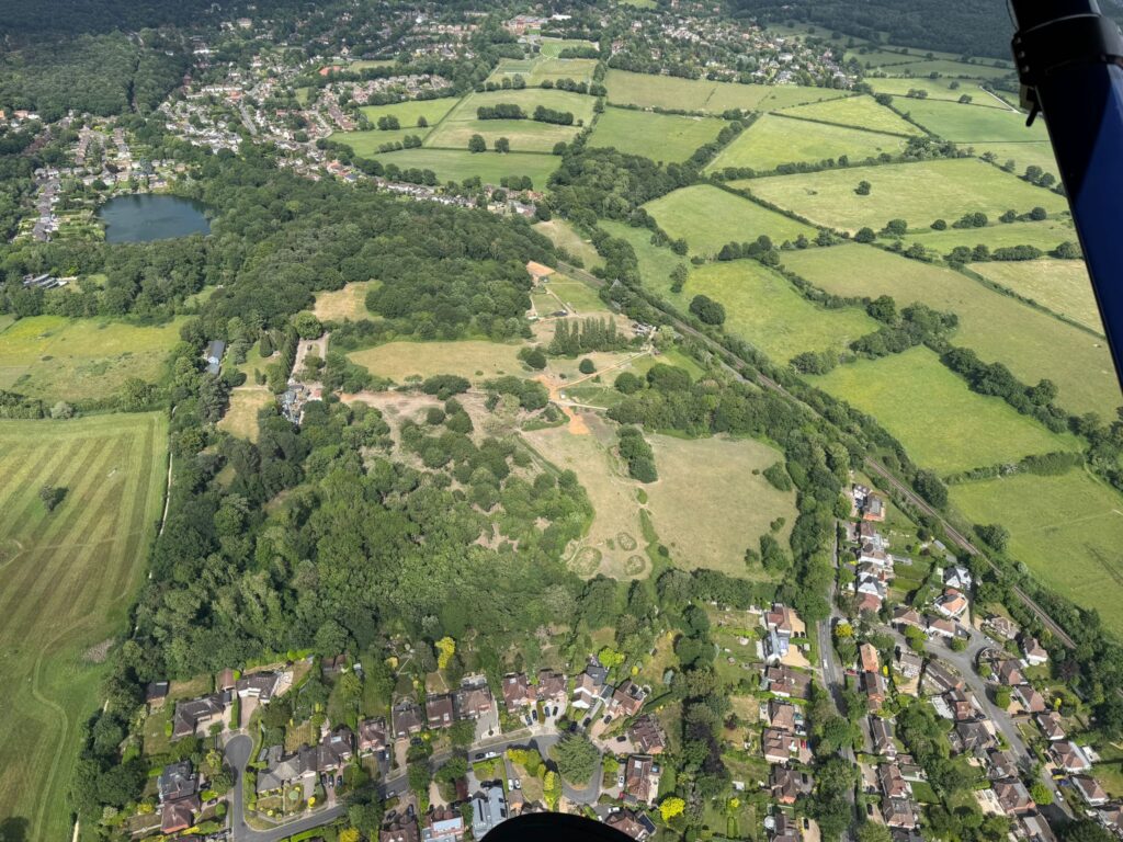
Surrey Highways has withdrawn its objection, so the application for 250 homes at The Paddocks (2025/1097) is heading to committee, expected Tuesday 10 November. Councillors count fresh comments. Even if you objected before, please do it again.
The one point to make
This is not a sustainable place for 250 homes. The developer’s own figures show 122 car trips in the morning peak against 7 by bus or train, and say Oxshott’s school and surgery are “generally beyond regular walking distance for most people”. A footpath over the bridge does not change that. Surrey’s own response in March rated walking to school and walking for health from this site as “very low”.
This matters because the site is Green Belt. The developer argues it is “grey belt”, land that can be built on, but a car-dependent site fails the grey belt test. If it is not sustainable, it stays Green Belt.
How to say it
In your own words, with your own experience: identical comments are grouped together and counted as one. For example:
I object to application 2025/1097. I live on [street]. I drive my children to Royal Kent every day because it is two kilometres away over a railway bridge with no pavement, and I drive to the surgery in Oxshott for the same reason. The developer’s own report says people will do the same from this site. A footpath does not make this a sustainable location for 250 homes in the Green Belt.
Swap in your own school, surgery, shops or station: the point is where you actually go and why you drive.
One request: focus on “not sustainable” and “not assessed”, not “not safe” or “dangerous”. Whatever you think of the bridge, Surrey Highways has already given its opinion on it and says it can be made safe.
How to object
Email tplan@elmbridge.gov.uk quoting 2025/1097 and saying you object, or comment on the Council’s website.
Tuesday 10 November, 7pm, Civic Centre, Esher
Then put Tuesday 10 November, 7pm, Civic Centre, Esher in your diary. Only one objector is allowed to speak, so a full, quiet room is how councillors see what the village thinks. Arrive by 6.30pm. The agenda isn’t published yet; we’ll confirm the date as soon as it is.
More detail, and other points you can make
What has changed
Until this month the application had a formal objection from Surrey County Council Highways, the statutory body that advises Elmbridge on roads. In March, Surrey recommended refusal. It rated the site’s connectivity for walking to school and walking for health as “very low”, and said there was no safe walking route over the railway bridge to Oxshott’s school and surgery. On 9 October, Surrey withdrew that objection in return for the developer agreeing to build a footpath over the bridge, subject to a long list of conditions. That removes the last statutory objector, which is why the application is now heading to committee.
In short: 150 metres of single-lane traffic over the railway bridge controlled by lights, queues of 70 to 100 metres at peak times, and a 1.8-metre fence along a bridge that Network Rail has not yet agreed to alter. And none of it has to be built until 100 of the 250 homes are occupied.
Also:
- a two-lane widening at the Blundel Lane/Stoke Road junction beside the Field of Hope, whose effect on the giant sequoia has not been assessed
- relocated bus stops on Stoke Road and new ones on Blundel Lane
- no assessment of traffic diverting via Littleheath Lane and Water Lane
Five more points, if you want to add one
Again, in your own words.
The site is too far from a station. The national planning rules (the NPPF) were updated in August 2026 and favour new homes within 800 metres of a railway station. This site is about 1,350 metres away, and no part of it is within 800 metres.
The site is among the least connected in the country. The Department for Transport’s connectivity tool puts it in the lowest 10–20% of sites nationally. Surrey Highways’ own formal response to Elmbridge on 5 March 2026 said: “The connectivity scores for walking to school and walking for health are both rated as very low.” Those scores measure distance and time, not whether there is a pavement, so a footpath over the bridge does not change them. The school and the surgery are where they are.
The footpath isn’t even shown to work. The plan makes the railway bridge single-lane for 150 metres, with traffic lights letting one direction through at a time. Last year Surrey’s own road-safety and traffic-light engineers said they did not believe this could work as it was then designed: the longest set of lights like this anywhere in Surrey is also 150 metres and allows up to 52 seconds for the road to clear; this design allows 36. The only traffic model is from October 2024, nothing shows Surrey’s engineers have looked at it again, and nothing on file shows Network Rail, which owns the bridge, has agreed to the works.
The effect on the rest of the village hasn’t been assessed. Nobody has assessed what 150 metres of one-way working and queues of 70 to 100 metres will do to ambulance and fire-engine access between Stoke D’Abernon and Oxshott. Surrey says diverted traffic “would be minimal”, but there is no assessment of Littleheath Lane or Water Lane on the file. The developer’s own figures put the wait at the lights at around 50 seconds per vehicle, rising to 75 to 80 seconds whenever a cyclist is in the section.
The footpath isn’t secured. In March Surrey said it had to be built before the first home was occupied, and the developer agreed in August. The plan now allows 100 homes to be occupied before it exists, and nothing on the file explains why. Even built on day one, it doesn’t change where the school, surgery and shops are.
View the application and all documents here.
Thank you for your continued support.
Stoke D’Abernon Residents’ Association